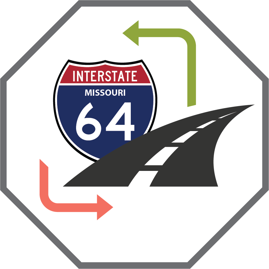
About the Study
The central corridor between Kingshighway and Jefferson is vibrant and changing. The Missouri Department of Transportation (MoDOT) wants to ensure bridges and interchanges are safe, maintained, and updated for all users. The first step in this process is a planning and environmental linkages (PEL) study to analyze long term goals for improvements to the corridor.

Click on the image to enlarge.
Purpose and Need
The Purpose and Need is critical. A PEL develops a vision and options for cooperative transportation investment across regional government agencies. Understanding the P&N of a planning study and being able to successfully incorporate such needs and goals into a future environmental study will allow projects that result from the planning study to move forward more quickly.
Project Needs
The needs are the key problems and the causes of those problems that MoDOT is seeking to address with transportation improvements on I-64 between Kingshighway Blvd and Jefferson Ave.
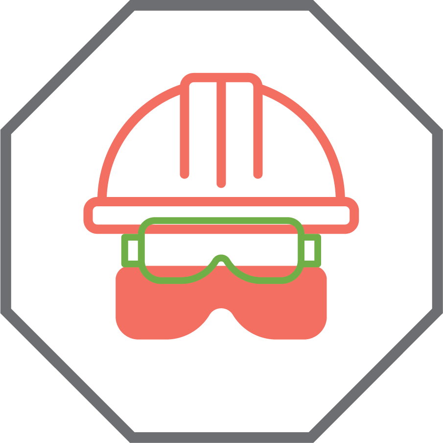
Increase safety for all users
Maintain Interstate function, operations, and capacity for future use
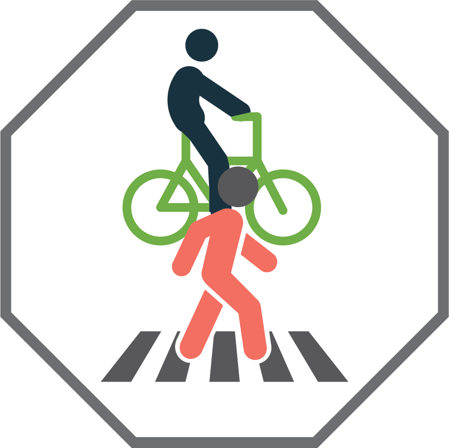
Reduce barrier effect of I-64 for bicycle, pedestrian, and transit users
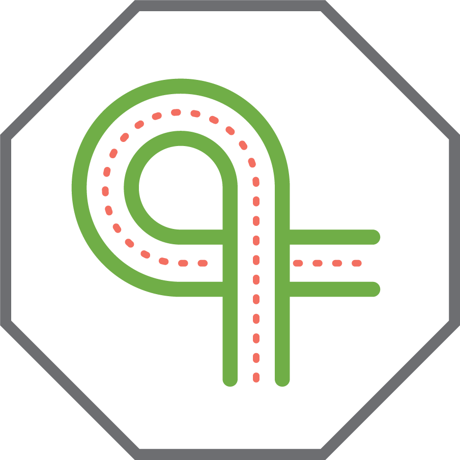
Improve transportation system with intuitive navigation to, from, and across I-64
Optimize bridge maintenance by improving structural conditions to maintain a good state of repair
Project Goals
Project outcomes beyond the identified transportation needs are included as goals. The goals help balance environmental, transportation and other community values.
- Right-size I-64 to reuse available space to benefit the community
- Support improved land use near transit stations and trails
- Improve equitable outcomes for disadvantaged communities
- Coordinate with regional partners to enhance the location transportation network
- Integrate bicycle and pedestrian facility design best practices into project designs
- Consolidate access points from interstate to local system
- Invest in projects that provide good cost benefit improvements
- Integrate ecology best practices into project designs and right-of-way use
- Integrate improved aesthetics and visual environment into project designs
What Have We Heard?
Public and community engagement has been, and continues to be, a very important part of this process. This study incorporated ongoing, equitable and inclusive engagement to help ensure that a wide range and extensive number of voices are heard, and that equity is the focus of proposed solutions.
How was the public involved?
Community and stakeholder outreach is a significant component in learning how transportation infrastructure affects communities and those that use the roads for travel. The public was brought in at the early stages of the PEL study to identify the relevant problems and needs, which helped guide the development of possible solutions. The corridor vision has been developed in collaboration with city authorities, MoDOT, key stakeholders, community partners, and those who use the corridor. Opportunities to comment on the P&N helped clarify unresolved concerns that the public, stakeholders, and agencies shared with MoDOT.
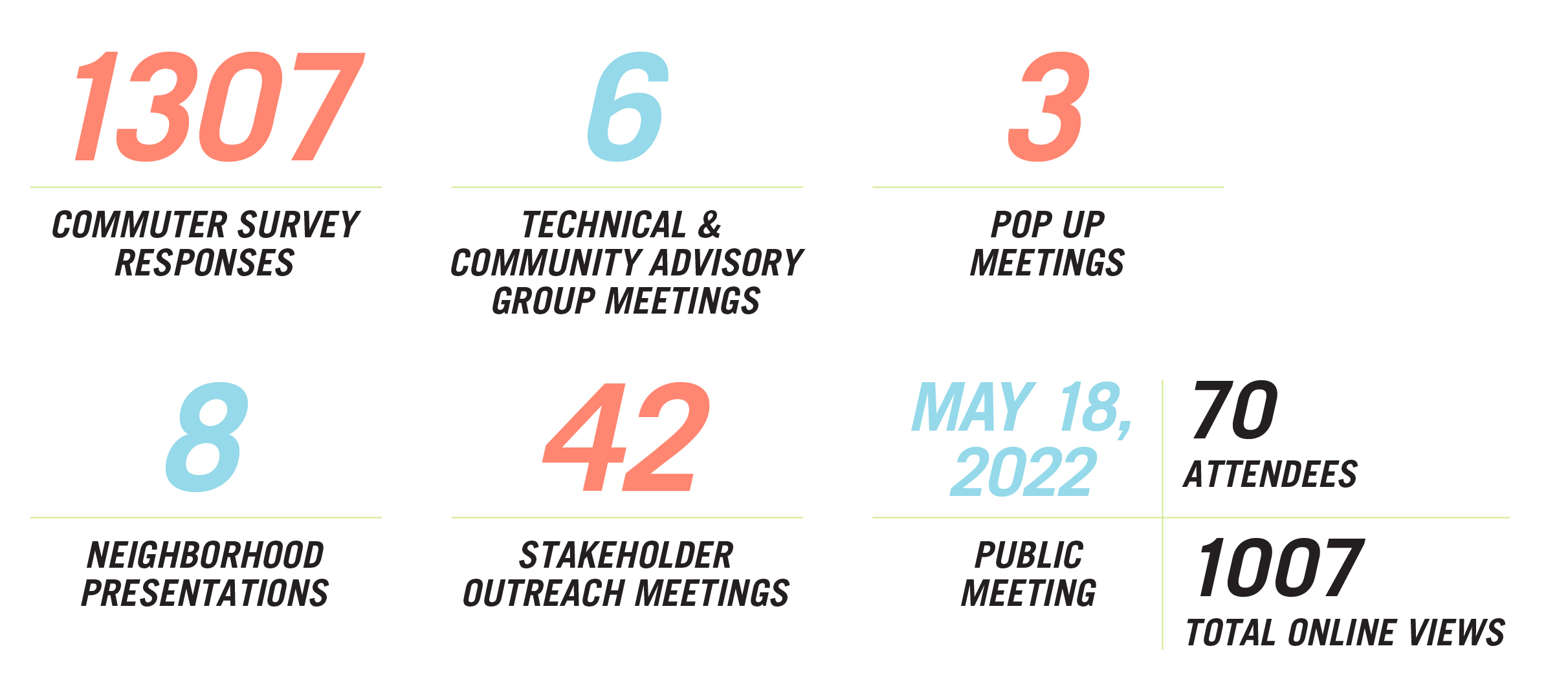
What we heard
Among the things we heard from the public was the need to reduce the barrier effect of I-64 to better fit the community and to create access benefitting a diversity of people. We also heard about the importance of different modes of transportation and the need to coordinate with regional partners to enhance the local transportation network that supports people walking, biking, and taking public transit.
What we did with this information
We used the information gathered during our public outreach to develop the Purpose and Need and add project goals as a secondary screening criteria. This allowed the study team to filter out new ideas for ramp designs that were not consistent with the needs the public identified.
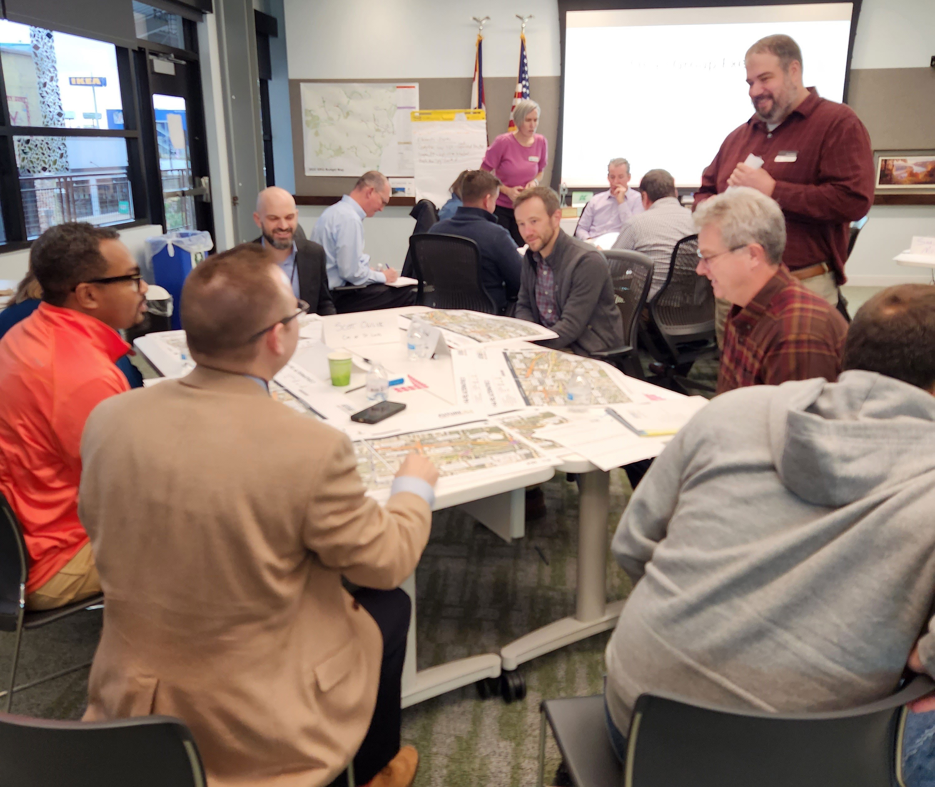
Community partners have been involved in the decision-making process guiding the study.


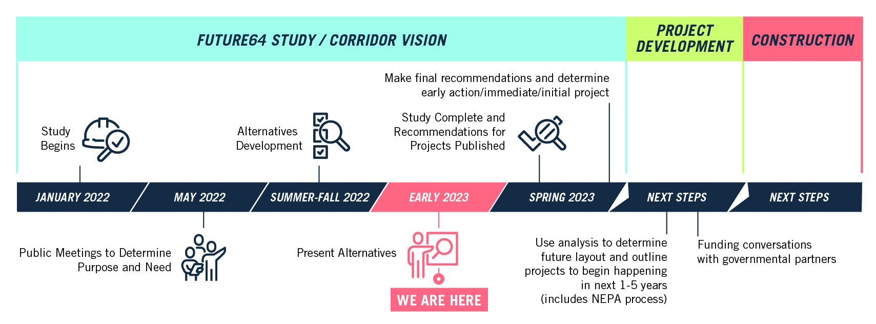
Decision Making Process
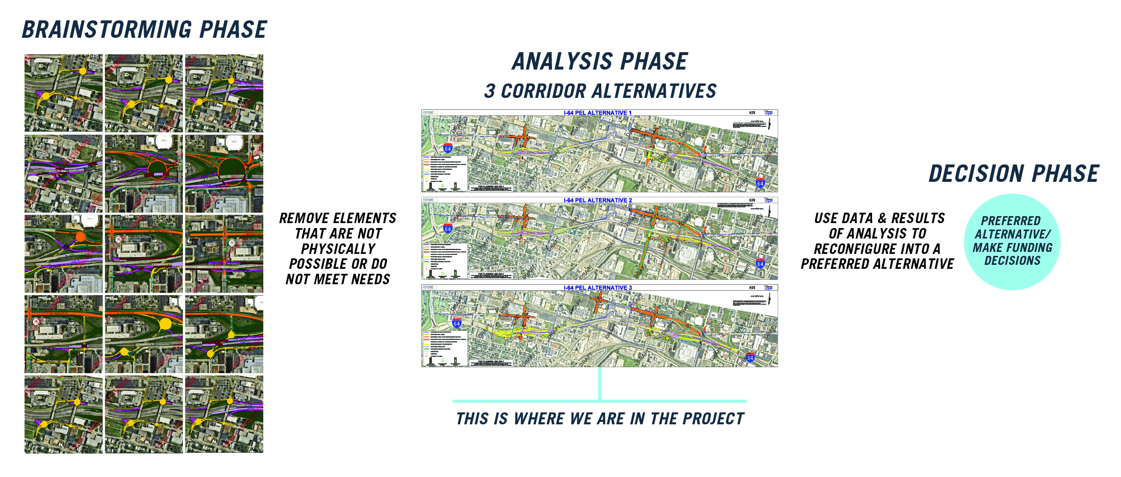
Brainstorming Phase
The project team held workshops with local and statewide MoDOT leaders, national design experts, community partners, and stakeholders to brainstorm ideas for the corridor. This phase helped inform the development of 17 possible design changes that have the potential to address the needs for this corridor.
The design options were then screened through the study's goals and Purpose and Need. The design options that would result in new issues or did not meet the Purpose and Need were removed.
Analysis Phase
The remaining ideas from the brainstorming phase were assembled into three full corridor alternatives, designed to represent a variety of options. A full safety and traffic analysis was run on each alternative to determine how the ideas would work together as a system and to find the strengths and weaknesses of the different elements. A community assessment was also done to address possible benefits and opportunities of the new road layout.
The results of this analysis of all three alternatives, as compared to the existing configuration (No Build) have now been collected and documented and it is time to share this rich information with the public. This is the current phase we are in, and we need your input before we move on to the next phase.
Decision Phase
We will assemble input from the public with the results of our analysis to begin making decisions about the future of the corridor. Collaborating closely with our coordinating partners (St. Louis City, Metro, Great Rivers Greenway and East-West Gateway, etc.), we will put together one vision for the future of the I-64 corridor based on rigorous analysis and community input. There will be more opportunities for public viewing and input in this phase.
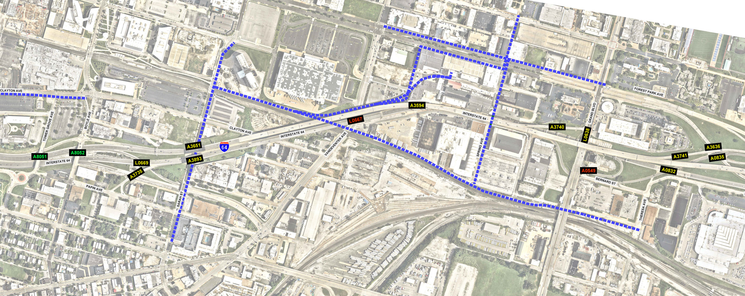
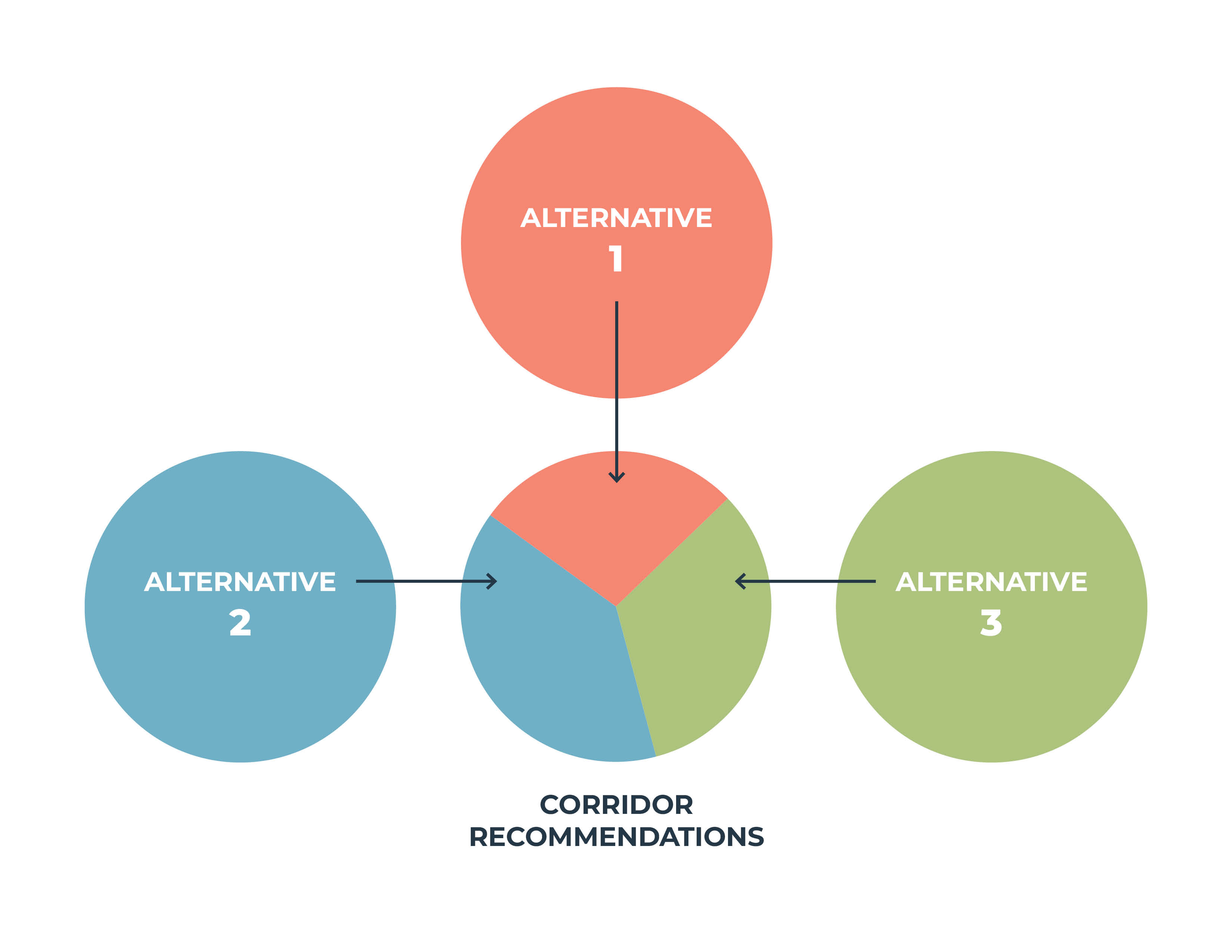
Overview of Alternatives (Analysis Phase)
The final three alternative options were redeveloped in response to the insight received through the process. The alternatives were evaluated against the no-build alternative using the Purpose and Need as screening criteria.
- No Build: The No Build incorporates an estimated 12 miles of bike and pedestrian facilities that are either committed or likely to happen. However, would not address any of the four needs identified in the study. MoDOT would still need to invest approximately $100M in bridge repairs.
- Alternative 1: Lowest cost but unresolved vehicle congestion issues remain. See the Alternative 1 slide for more information.
- Alternative 2: Greatest potential to reduce barrier effect and has benefits to transit service and access. Has the highest cost to local transportation improvements. See the Alternative 2 slide for more information.
- Alternative 3: Greatest benefit to congestion, safety, and redevelopment but has the highest cost. See the Alternative 3 slide for more information.
- Final Recommendations: Features of all three alternatives will be further evaluated. See the Final Recommendations slide for more information.
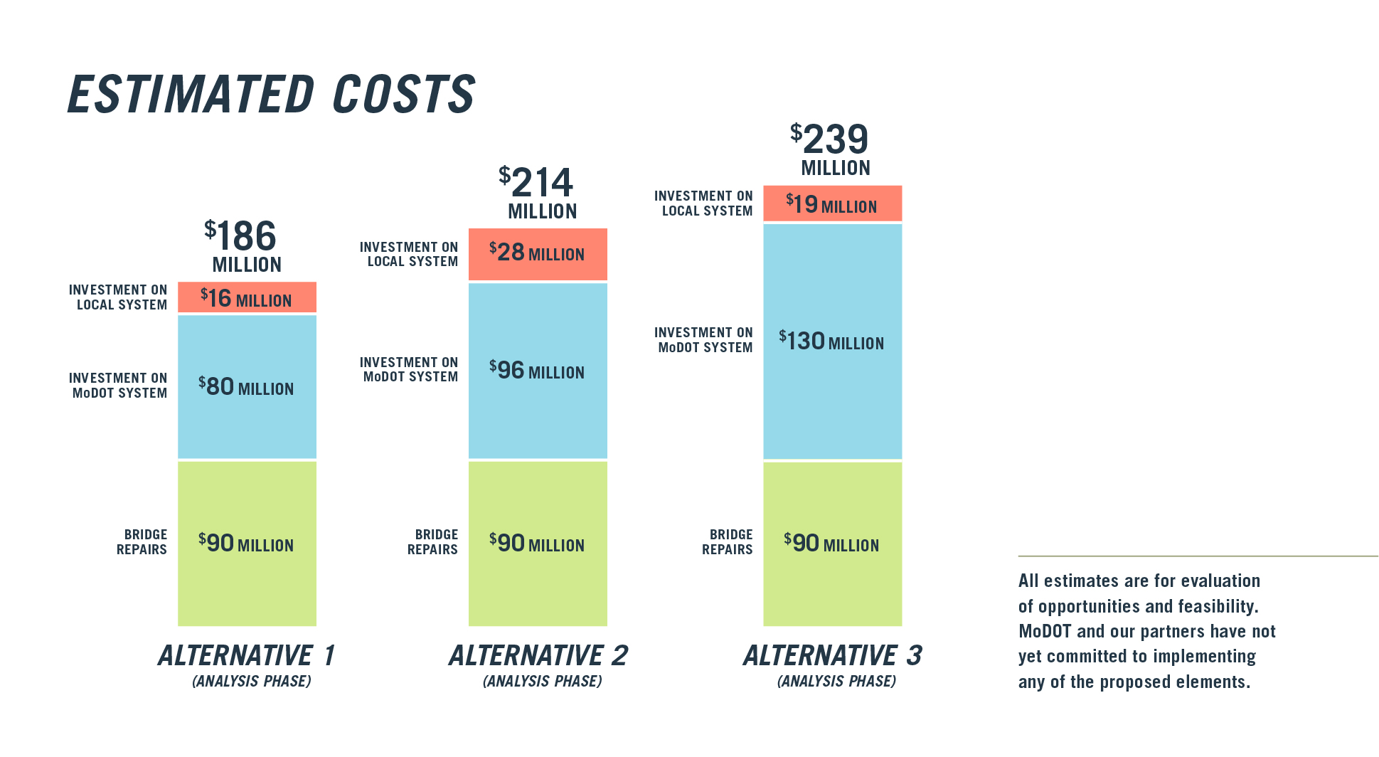
Estimated Costs
The cost for the three alternative options varies. In the No-build Alternative, MoDOT would invest approximately $100 million to maintain I-64 bridges in the study area.
Click on the image to enlarge.
All estimates are for evaluation of opportunities and feasibility. MoDOT and our partners have not yet committed to implementing any of the proposed elements.
No Build
The No-build Alternative represents what would happen if MoDOT didn't make any changes in the study area. MoDOT would invest in maintaining the system as it currently exists. In this scenario, the other entities that have plans in the study area would still make their improvements.
Key Planned Improvements by Others
- Brickline Greenway crossing I-64 at Spring
- Brickline Greenway connecting Grand and Cortex MetroLink stations
- Tower Grove Connector extension on Sarah
What Happens if MoDOT Does Not Make Changes (by 2050)?
- Expected increase in congestion
- Continued safety issues for all types of users
- Limited improvement to barrier effect
- Continued issues with the ability to navigate I-64 and local roadway system
Click on the image to enlarge.
Alternative 1 (Analysis Phase)
Key Features
- Consolidates access at Grand
- Lengthens auxiliary ramps
- Creates a new north-south connection on Theresa Ave to I-64.
Key Benefits & Issues
- Benefit: Lowest cost for transportation improvements
- Issue: Some unresolved vehicle congestion issues remain
- Issue: Least improvement to accessing MetroLink stations
Click or tap on the circles on the map to learn more about potential improvements at that location. View the full map (11MB).
Clayton & Boyle
Realign & improve intersection with additional turn lanes to improve traffic flow.
Boyle WB I-64 Off-ramp
Added lane and lengthen ramp to improve traffic flow and reduce backups onto I-64.
Forest Park & Grand
Convert existing intersection to at-grade intersection.
Grand WB I-64 Off-ramp
Realign off-ramp for direct access to Grand Blvd.
Bernard St EB I-64 On-/Off-ramps
New I-64 EB ramps provide direct access to Grand, and allows for removal of entrance ramp on the left to EB I-64.
Increase safety for all users
Maintain Interstate function, operations, and capacity for future use
Reduce barrier effect of I-64 for bicycle, pedestrian, and transit users
Improve transportation system with intuitive navigation to, from, and across I-64
Optimize bridge maintenance by improving structural conditions to maintain a good state of repair
Click or tap on the map to learn more about potential improvements at that location. View the full map (11MB).
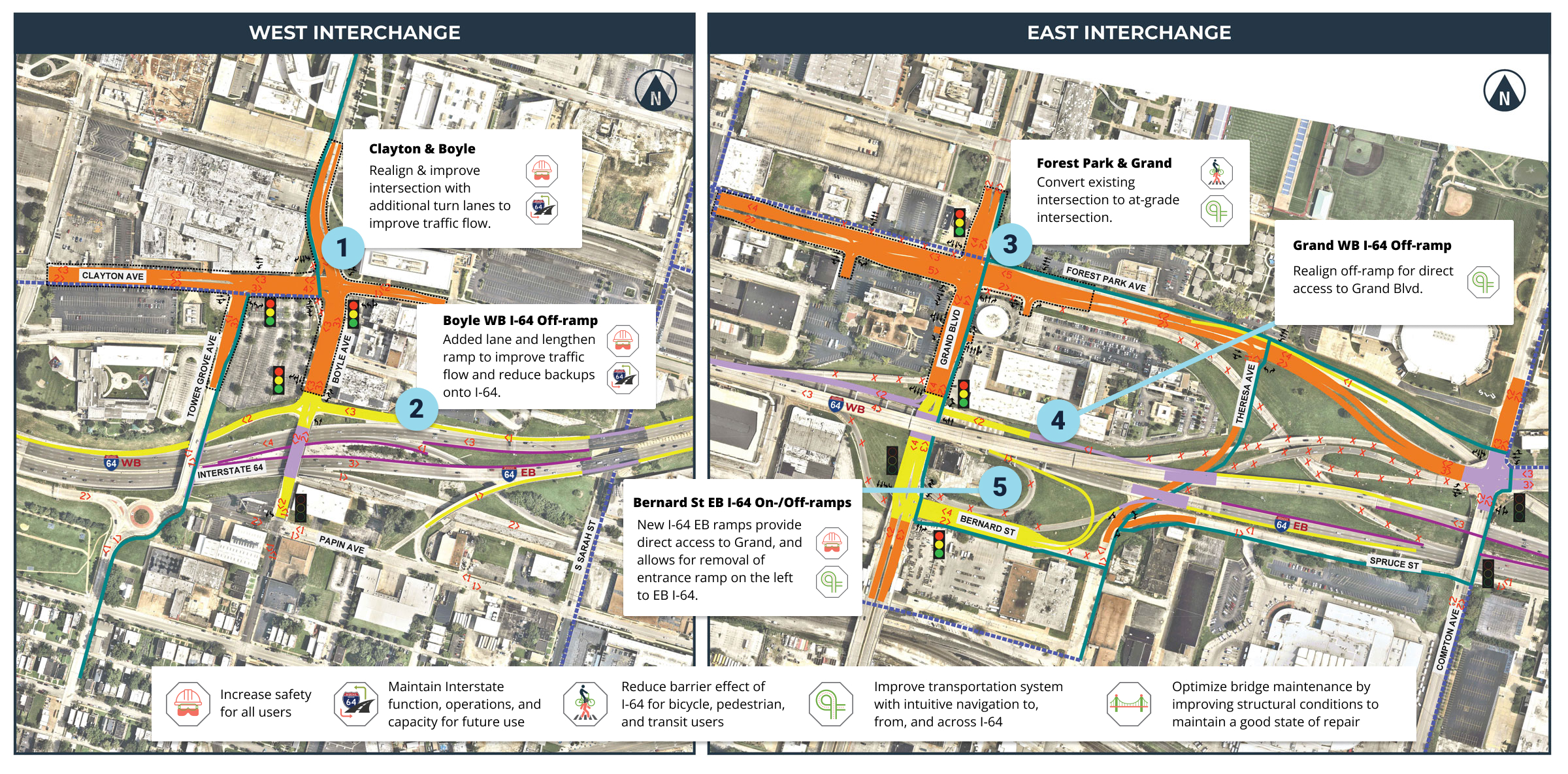
All drawings are for evaluation of opportunities and feasibility. MoDOT and our partners have not yet committed to implementing any of the elements shown.
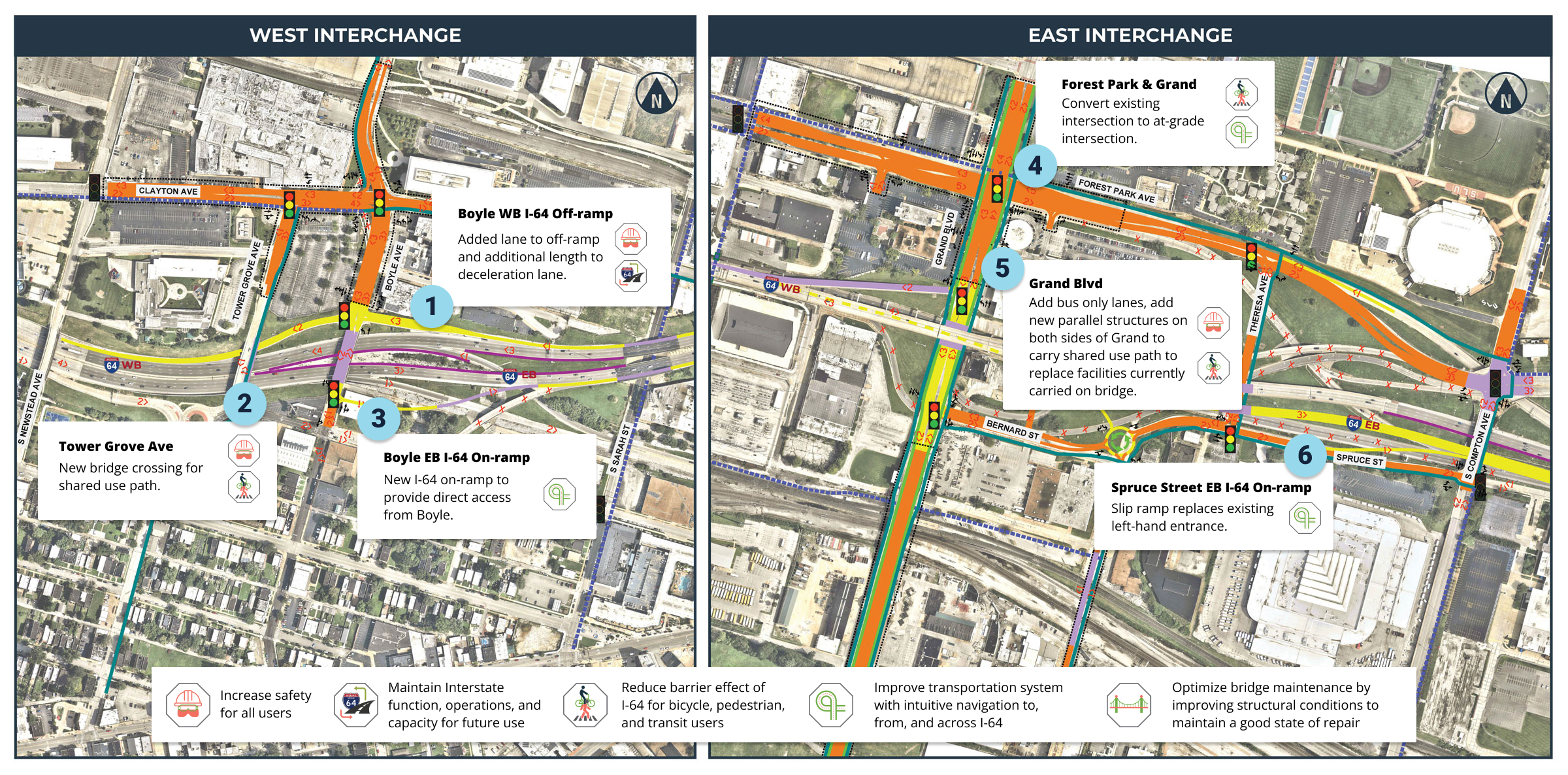
Alternative 2 (Analysis Phase)
Key Features
- Creates a new eastbound on ramp from Boyle
- Creates bus only lanes on Grand between Choteau and Forest Park Avenue
- Builds a new Theresa Avenue bridge over the railroad tracks
Key Benefits & Issues
- Benefit: Greatest potential for reducing the barrier effect of I-64
- Benefit: Improves highest ridership bus route & access to MetroLink stations
- Benefit: Reduces traffic congestion issues
- Issue: Highest cost for improvements to local transportation system
Click or tap on the circles on the map to learn more about potential improvements at that location. View the full map (11MB).
Boyle WB I-64 Off-ramp
Added lane to off-ramp and additional length to deceleration lane.
Tower Grove Ave
New bridge crossing for shared use path.
Boyle EB I-64 On-ramp
New I-64 on-ramp to provide direct access from Boyle.
Forest Park & Grand
Convert existing grade separated intersection into at-grade intersection.
Grand Blvd
Add bus only lanes, add new parallel structures on both sides of Grand to carry shared use path to replace facilities currently carried on bridge.
Spruce St EB I-64 On-ramp
Slip ramp replaces existing left-hand entrance.
New bridge connecting Theresa Ave
New bridge across railroad tracks reconnecting Theresa Ave.
Increase safety for all users
Maintain Interstate function, operations, and capacity for future use
Reduce barrier effect of I-64 for bicycle, pedestrian, and transit users
Improve transportation system with intuitive navigation to, from, and across I-64
Optimize bridge maintenance by improving structural conditions to maintain a good state of repair
Click or tap on the map to learn more about potential improvements at that location. View the full map (11MB).
All drawings are for evaluation of opportunities and feasibility. MoDOT and our partners have not yet committed to implementing any of the elements shown.
Alternative 3 (Analysis Phase)
Key Features
- Consolidates the Vandeventer and Tower Grove off-ramps
- Creates a new eastbound I-64 on ramp from Vandeventer
- Removes left-hand entrance ramps at Boyle/Papin/Tower Grove and Grand/Market/Bernard
Key Benefits & Issues
- Benefit: Reduces traffic congestion issues
- Benefit: Highest benefit to safety for all users
- Benefit: Greatest potential for redevelopment opportunities near I-64, transit, and trails
- Issue: Highest cost of transportation improvements
Click or tap on the circles on the map to learn more about potential improvements at that location. View the full map (11MB).
Tower Grove Ave
Convert existing Tower Grove bridge to a shared use facility, grade separate eastbound off-ramp from non-vehicular traffic.
Theresa Ave
Addition of Theresa Ave connection provides additional north/south connectivity and access to MetroLink.
Grand WB I-64 On-ramp
New on-ramp, signalize intersection.
Theresa EB I-64 Off-ramp
New eastbound ramps, removes left entrance ramp from eastbound I-64.
Vandeventer WB I-64 On-ramp
Convert westbound I-64 on-ramp from Vandeventer to right-hand entrance.
Vandeventer EB I-64 On-ramp
New eastbound access to I-64 from Vandeventer.
Increase safety for all users
Maintain Interstate function, operations, and capacity for future use
Reduce barrier effect of I-64 for bicycle, pedestrian, and transit users
Improve transportation system with intuitive navigation to, from, and across I-64
Optimize bridge maintenance by improving structural conditions to maintain a good state of repair
Click or tap on the map to learn more about potential improvements at that location. View the full map (11MB).
All drawings are for evaluation of opportunities and feasibility. MoDOT and our partners have not yet committed to implementing any of the elements shown.
Final Recommendations
The three alternatives presented have been used for analysis purposes.
A preferred alternative has not yet been selected. Elements from all three of the alternatives will move forward into the next phase including further evaluation of environmental impact, engineering design, and public engagement. This will create one preferred alternative for future construction that could be a hybrid of the three alternatives.
Next Steps
MoDOT will continue to work with regional government partners to identify funding options, conduct environmental studies, and refine engineering designs to advance Future64.
As the study moves forward, we will create an action plan based on the three alternative options. This plan will outline investment priorities such as bridge repair and replacement and will identify elements that need further development with the study partners.
Click on the image to enlarge.
Thank You
Thank you for your participation in today's Virtual Online Meeting. We appreciate your input. If you have any comments or questions, please reach out to us using the methods below.


